Bridges · Wales
Conwy Suspension BridgeSuspension bridge by Thomas Telford (1826), Conwy, Wales
- Type
- Suspension bridge
- Built
- 1826
- Where
- ConwyWales
- Today
- Standing (footbridge; National Trust)
- Telford's part
- Designer
- Location
- 53.2805, -3.8238approximate
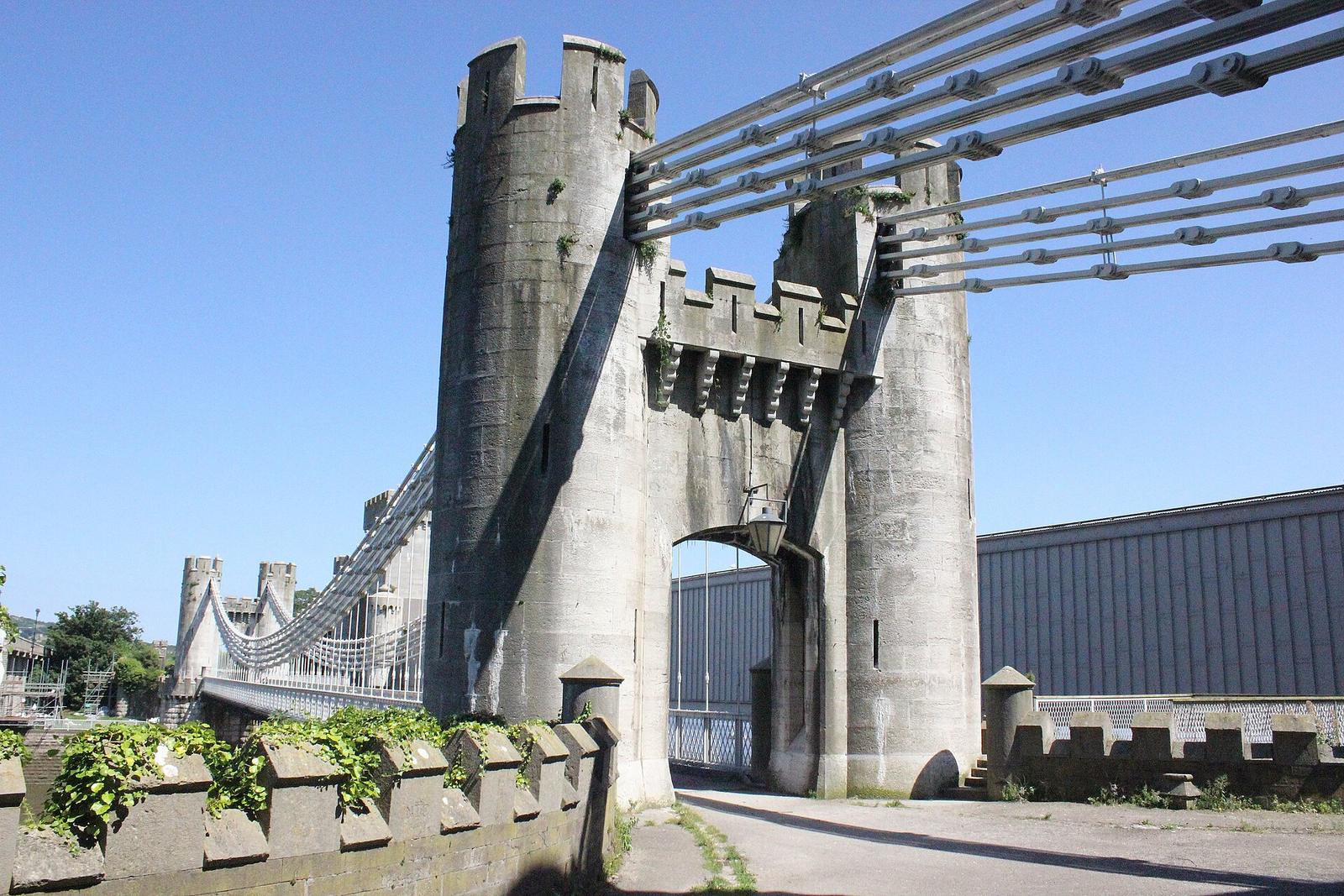
Telford dressed his Conwy bridge as part of the castle it stands beside. Built in 1822 to 1826 with the same chain technology as Menai, it carried the Chester to Bangor road across the river until 1958. Today it is a footbridge in the care of the National Trust.
What you are looking at
A single deck hangs from iron chains over a span of 327 feet (about 100 metres). The chains pass over two pairs of limestone towers built as battlemented turrets, joined by castellated walls with carriageway arches about 10 feet wide between them. The towers are about 40 feet high. Telford chose the Gothic style to match Conwy Castle.
The chains are wrought-iron links pinned together in the same way as those at Menai, and these are still the originals. At Menai the iron chains were replaced with steel in 1938 to 1940, so Conwy is the place where you can see what Telford's chains looked like. The east chains anchor in a plinth of stone and concrete. On the west side they run into the castle's eastern barbican and the rock beneath, and part of the castle was taken down to make room for them.
Who built it
Telford designed it for the Holyhead road, and William Hazledine supplied the ironwork. It was built from 1822 and opened on 1 July 1826, replacing the ferry at this crossing, at a cost of about £51,000. Telford and W. A. Provis are named as its engineers on the bridge's plaque, and the deck was replaced and strengthened with side trusses in 1896. The toll keeper's house beside the bridge, with its little turrets, is part of the same design. In the 1890s a family of six lived in it and took the tolls day and night.
Three bridges side by side
Robert Stephenson's tubular railway bridge opened alongside Telford's in 1849, and the modern road bridge followed in 1958. On 13 December 1958 the new road bridge took over the traffic and Telford's bridge closed to vehicles. It was then in line for demolition, but a public outcry saved it, and the National Trust has owned it since 1965. It is Grade I listed as a major work of nineteenth-century engineering.
Visiting
- Walk across. The bridge is open to pedestrians and cyclists. The castle stands beside it, and the view that takes in all three bridges is the reason to go.
- The toll house. The National Trust shows the outside of the toll keeper's house and garden. Check the Trust's page for whether it opens inside.
- No parking on site. Use one of the town's car parks. Conwy station is about a quarter of a mile away.
- Castle. Conwy Castle, a World Heritage Site run by Cadw, is right beside the bridge.
Check opening times and access with the National Trust before you travel.
Questions people ask
How long is Conwy Suspension Bridge?
The span between the towers is 327 feet (about 100 metres). The National Trust gives the length as 99.5 metres, or 326 feet.
When did it open?
1 July 1826, after four years of building. It was built at the same time as the larger Menai bridge and uses the same technology.
Can you drive across it?
No. It closed to traffic in 1958 and is now a footbridge.
Are the chains original?
Yes. The deck has been replaced, but the wrought-iron chains are the originals, unlike those at Menai.
Who owns it?
The National Trust, since 1965.
Why does it look like a castle?
Telford designed the towers and walls in the Gothic style to match Conwy Castle next door, and the chains are anchored into the castle's rock.
On the map
Open on the full map · Directions
Nearby Telford works
- Toll house at Conwy Suspension BridgeTollhouse · 0.1 miles away
- Telford Milestone 30, BethesdaMilestone · 12 miles away
- Telford Milestone 38, Capel CurigMilestone · 12 miles away
- Telford Milestone 37, Capel CurigMilestone · 12 miles away
- Telford Milestone 28, LlanllechidMilestone · 12 miles away
- Telford Milestone 31, LlanllechidMilestone · 12 miles away